- Mumbai Hype
- Posts
- How Mumbai Rose from Seven Islands: The Incredible Transformation Story
How Mumbai Rose from Seven Islands: The Incredible Transformation Story
Discover how Mumbai transformed from seven separate islands into India's largest megacity. Explore the fascinating land reclamation history that shaped Maximum City.
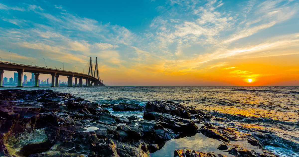
When you walk through the bustling streets of Mumbai today, it's nearly impossible to imagine that this sprawling megacity of over 20 million people once existed as seven separate islands. The story of how Mumbai was formed from islands is one of ambition, engineering brilliance, and centuries of transformation that turned a scattered archipelago into India's financial powerhouse.
The Seven Islands: Mumbai's Ancient Foundation
Long before the skyscrapers, local trains, and the iconic Gateway of India, Mumbai's story began with seven distinct islands: Isle of Bombay, Colaba, Little Colaba (Old Woman's Island), Mazagaon, Parel, Worli, and Mahim. These islands, separated by shallow creeks and marshlands, were home to the Koli fishing community—the original inhabitants whose descendants still practice their traditional livelihood along Mumbai's coastline today.
Archaeological evidence suggests these islands have been inhabited since the Stone Age. The Kolis, who gave the islands their earliest identity, lived in harmony with the sea, their lives intertwined with the tides and the abundant fish that filled the Arabian Sea waters.
The islands weren't just isolated fishing hamlets, though. They formed part of several powerful kingdoms throughout history. From the Mauryan Empire under Emperor Ashoka in the 3rd century BCE to the Silhara dynasty that controlled the region between the 9th and 13th centuries, these islands witnessed the rise and fall of numerous rulers. Later, they came under the control of the Gujarat Sultanate before the Portuguese arrived and changed everything.
The Portuguese Era: Bom Bahia Becomes Bombay
In 1534, the Portuguese took control of the islands, recognizing their strategic location for maritime trade. They christened the islands "Bom Bahia," meaning "Good Bay" in Portuguese—a name that would eventually evolve into "Bombay." The Portuguese built forts, churches, and settlements, leaving architectural legacies that still stand today, including the Mount Mary Church in Bandra.
However, the Portuguese never fully realized the potential of these islands. They focused primarily on Goa as their main Indian colony, and the seven islands of Bombay remained relatively underdeveloped. The islands' landscape during this period was characterized by low hills, dense mangrove forests, salt pans, and tidal mudflats that made movement between islands difficult except during low tide.
The British Takeover: A Dowry That Changed History
The turning point in Mumbai's history came in 1661 when the seven islands became part of the dowry of Portuguese Princess Catherine of Braganza when she married England's King Charles II. This seemingly minor detail in a royal marriage contract would have monumental consequences for the Indian subcontinent.
Initially, the British Crown wasn't particularly interested in these swampy, mosquito-infested islands. In 1668, King Charles II leased the islands to the British East India Company for a mere ten pounds of gold per year—a decision that would prove to be one of history's most undervalued real estate transactions.
The East India Company, however, immediately recognized what the Crown had missed: these islands offered a natural deep-water harbor, protection from monsoons, and a strategic position for trade along India's western coast. They set about transforming the islands with a vision that would take over 150 years to fully realize.
The Hornby Vellard: Engineering Marvel of the 18th Century
The most ambitious undertaking in Mumbai's transformation was the Hornby Vellard project, named after William Hornby, the Governor of Bombay from 1771 to 1784. A "vellard" refers to a causeway or embankment, and this project aimed to reclaim land and connect the seven islands into a single landmass.
The project began in 1784 and involved constructing massive causeways between the islands, building seawalls to prevent flooding, and systematically filling in the shallow channels that separated the islands. It was an engineering feat of staggering proportions for its time, accomplished without modern machinery—just human labor, ingenuity, and determination.
The Hornby Vellard project connected Bombay Island in the south with the more northern islands of Mahim, Worli, and Parel. Engineers built a three-kilometer-long causeway that kept out the high tides and allowed the marshlands to be drained and reclaimed. The project took over 50 years to complete, finally finishing around 1845.
This land reclamation didn't just connect islands—it created valuable new urban space. Salt pans were converted into residential areas, mangrove swamps became neighborhoods, and tidal creeks transformed into roads. The reclaimed land would eventually house some of Mumbai's most iconic areas.
From Fragments to Unity: The Birth of Modern Bombay
By the mid-19th century, the seven islands had merged into a single connected landmass. But Mumbai's land reclamation story didn't end there. Throughout the 19th and 20th centuries, additional reclamation projects continued to expand the city's footprint. The Back Bay reclamation project in the early 1900s added more land along the western coast, creating space for Marine Drive—the art deco-lined promenade that became one of Mumbai's most beloved landmarks.
The transformation accelerated during the cotton boom of the 1860s when the American Civil War disrupted global cotton supplies, and Mumbai emerged as a major cotton trading center. Wealth poured into the city, funding magnificent Victorian Gothic and Art Deco buildings that still define South Mumbai's skyline. The iconic Chhatrapati Shivaji Terminus (formerly Victoria Terminus), completed in 1887, stands as a testament to this golden age.
The opening of the Suez Canal in 1869 further cemented Mumbai's importance as a trading hub, reducing the travel time between Europe and India dramatically. The city became the subcontinent's primary gateway, attracting people from across India who came seeking opportunities in its factories, mills, and trading houses.
The Immigrant City: Where Cultures Converge
As Mumbai grew from a collection of islands into a unified metropolis, it became a magnet for migrants. Gujaratis, Marwaris, Parsis, South Indians, and people from every corner of India arrived, bringing their languages, cuisines, and cultures. The original Koli community, while still present, became just one thread in Mumbai's increasingly diverse tapestry.
This diversity became Mumbai's defining characteristic. Unlike cities that developed around a single ethnic or cultural identity, Mumbai's island origins meant it was always a place of convergence—where different communities had to learn to coexist, trade, and collaborate. This cosmopolitan character remains Mumbai's greatest strength today.
The neighborhoods that emerged reflected this diversity: Colaba became the European quarter with its colonial architecture; Bhendi Bazaar developed as a Muslim commercial hub; Girgaum housed Gujarati and Marathi communities; Bandra attracted Portuguese Catholics and later became a Bollywood haven; and Dadar emerged as a center of Marathi culture.
Modern Mumbai: Maximum City
Today, when you look at a map of Mumbai, you see no trace of the seven original islands. The creeks and channels that once separated them have been replaced by roads, railways, and buildings. Yet the legacy of the islands persists in subtle ways.
The slightly hilly terrain in areas like Malabar Hill and Cumballa Hill? Those are the remnants of the islands' original topography. The way certain neighborhoods have distinct identities? That's partly because they developed on different islands. Even the Koli community continues to fish from the same shores their ancestors used centuries ago, maintaining a direct link to Mumbai's island past.
Modern Mumbai has continued the land reclamation tradition. Nariman Point, Mumbai's central business district, sits entirely on reclaimed land from the 1960s-70s. The Bandra-Kurla Complex, another major business hub, was built on swampland in the 1970s-80s. And plans for future expansions, including the controversial Coastal Road project, continue the centuries-old practice of creating new land from the sea.
The Price of Progress
Mumbai's transformation from seven islands to a megacity came at a cost. The extensive land reclamation destroyed vast areas of mangrove forests and wetlands that served as natural flood barriers and biodiversity hotspots. Today, Mumbai faces chronic flooding during monsoon season—a problem partly rooted in the loss of these natural drainage systems.
The creeks and waterways that remain are often heavily polluted, a stark contrast to the pristine shores that the Kolis once fished. As climate change brings rising sea levels, the irony isn't lost on planners: a city built by reclaiming land from the sea now faces threats from that same sea.
Conservation efforts are underway to protect remaining mangrove patches and restore some coastal ecology, but balancing Mumbai's relentless growth with environmental sustainability remains one of the city's greatest challenges.
Lessons from the Islands
The story of Mumbai's seven islands offers lessons that resonate far beyond the city itself. It demonstrates human ingenuity's capacity to reshape landscapes, but also the unforeseen consequences of such ambition. It shows how diverse communities can forge a shared identity while maintaining distinct cultures. And it reminds us that cities are never static—they're constantly evolving, shaped by those who inhabit them.
For Mumbai's residents, understanding this history adds depth to daily life. That train journey from Churchgate to Bandra? You're traveling across what were once separate islands connected by human determination and engineering. That landmark you pass every day? It might stand on land that didn't exist 150 years ago.
The Island Spirit Lives On
Walk along Worli Fort at sunset, and you can still see Koli fisherfolk mending their nets. Visit Mahim during the annual fair, and you'll witness traditions that predate the British, Portuguese, and perhaps even the earliest recorded history of the islands. Explore the Portuguese-era churches in Bandra and Mazagaon, and you're touching the period when these were still distinct islands with their own identities.
Mumbai's transformation from seven islands to India's financial capital is more than just a story of land reclamation and urban development. It's a testament to human ambition, adaptability, and the constant negotiation between past and present. The islands may have merged into one continuous landmass, but their spirit—fragmented, diverse, resilient—remains the essence of what makes Mumbai truly Maximum City.
As the city continues to grow, pushing ever outward and upward, it carries with it the legacy of those seven islands that once stood separate in the Arabian Sea. And in that story, we find not just Mumbai's past, but also the blueprint for its future—a reminder that great cities are built not just on land, but on vision, diversity, and the courage to imagine what could be.